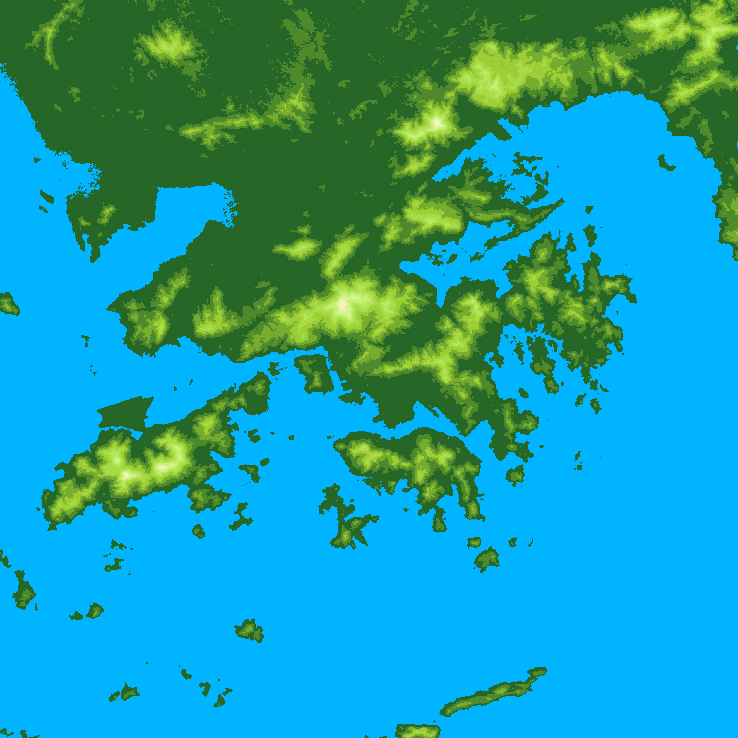
To create a map of terrain data, go to the ASTER website and download the 1 degree tile that you want. Then use this C program to plot. You may also need to install tiff and gd library before you compile.
sample output:
Obtain the *.hdf files from USGS